Google Earth Landslide Identification Practical

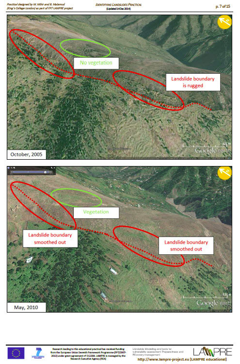
This Google Earth landslide practical is intended for public use, with little or no technical experience in landslides or Geographical Information Systems (GIS). This practical uses the tools available on Google Earth (which can be downloaded from 'Google Earth') and focuses on landslide identification and analysis. The practical discusses the steps you can take to identify and delineate landslide boundaries and assess landslides' extent and slope.
DOCX and PDF versions of the practical can be accessed below:
- MS Word version of Google Landslide Identification Practical (DOCX, 10 Mb)
- Adobe Acrobat version of Google Landslide identification Practical (PDF, 2 Mb)

