LANDSLIP news
2022
International Knowledge Sharing Webinar – 17th May 2022

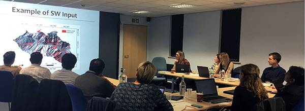
On 17th May 2022, the LANDSLIP team hosted an International Knowledge Sharing Webinar. A total of 141 people across the globe attended to hear from the entire LANDSLIP team what the project has learned and achieved in the past five years. Then, partners from the National Centre for Medium-Range Weather Forecasting, Amrita University, Save the Hills, and the Geological Survey of India, spoke about the impact of LANDSLIP on their work and their plans for the future. The webinar concluded with reflections on achievements and next steps by senior representatives from the Geological Survey of India, the National Disaster Management Authority and the UK Research and Innovation, India.
For more information on the event, please see:
- The meeting agenda of the webinar.
- A 5' LANDSLIP overview video of our achievements and outputs.
- Short videos of the LANDSLIP presentations on key achievements and lessons learned.
- The slides presenting an overview of the project components.
LANDSLIP key achievements video
The LANDSLIP team are delighted to share a short video with you that highlights the key achievements of the project.
2021
June 2021: International Symposium on IoT and ML for Ecosystem Restoration and Multi-Hazard Resilience

In June 2021, Amrita University’s UNESCO Chair on Experiential Learning for Sustainable Innovation and Development, Amrita School for Sustainable Development, and Amrita Center for Wireless Networks and Application hosted an International Symposium on IoT and ML for Ecosystem Restoration and Multi-Hazard Resilience (ISIM 2021) to celebrate the World Environment Day. The symposium invited perspectives from distinguished speakers and panelists from across the LANDSLIP consortium, including from Amrita University, Geological Survey of India, King's College London, Practical Action Consulting India, and Consiglio Nazionale delle Ricerche.
May 2021: LandAware MayDay conference

LANDSLIP members presented and attended the first conference of LandAware - the international network on Landslide Early Warning Systems - in May 2021. During the MayDay ‘Round-the-clock event, LANDSLIP consortium members shared their knowledge and experience via presentations and/or coordinated sessions on a variety of topics including:
- National and local landslide early warning systems - British Geological Survey
- Communicating and engaging with stakeholders - Practical Action Consulting UK
- Methods, opportunities and challenges of landslide data - Consiglio Nazionale delle Ricerche
- Perspectives on innovations from landslide early warning system operators - Geological Survey of India
The conference’s full video recordings can be viewed here.
April 2021: EGU2021 conference

The European Geosciences Union (EGU) General Assembly is a prominent annual event that brings together geoscientists from all over the world into one meeting covering all disciplines of the Earth, planetary and space sciences. At the EGU2021 virtual event in April 2021, several presentations were shared by the LANDSLIP team:
- Spatial Temporal Tracking of Landslide Events: A Crowdsourced Mobile App - Maneesha Vinodini Ramesh, Ramesh Guntha, Christian Arnhardt, Gargi Singh, Viswanathan Kr, Praful Rao, Gokul Halan, and Bruce Malamud.
- Structuring a Bayesian belief network using expert knowledge for landslide hazard assessment - Shreyasi Choudhury, Bruce D. Malamud, and Amy Donovan.
- A Landslide Tracker Methodology to Support Local Reporting of Landslides in India - Christian Arnhardt, Ramesh Guntha, Gargi Singh, Vish K.R Viswanathan, Praful Rao, Gokul Halan, Maneesha Vinodini Ramesh, and Bruce Malamud.
- Developing Efficient Web Crawler for Effective Disaster Management - Lakshmi S Gopal, Rekha Prabha, Divya Pullarkatt, and Maneesha Vinodini Ramesh.
- Technical Considerations for Building a Landslide Tracker Mobile App - Ramesh Guntha and Maneesha Vinodini Ramesh.
March 2021: Post-monsoon Nilgiris workshop
")
The Geological Survey of India organised a post monsoon workshop on the experimental regional landslide early warning system on 8th March 2021. A total of 50 members participated in the event including senior officials of the Geological Survey of India, the Tamil Nadu State Disaster Management Authority, Nilgiris District administration and selected LANDSLIP partners, among others.
The post-monsoon workshop promoted the exchange of lessons and experiences coming from the experimental regional landslide early warning system during the monsoon of 2020, under the framework of LANDSLIP. The event helped in joint-evaluation of the experimental regional early warning bulletins that were issued during the 2020 monsoon period for the Nilgiris.
The workshop enabled key decisions to be made among the partners to ensure more meaningful, effective and efficient organisation of the activities envisaged during the forthcoming 2021 monsoon, including supporting the systematic collection, organisation and transmission of rainfall and landslide data, through the landslide tracker mobile application and paper trackers.
2020
December 2020: Post-monsoon Darjeeling workshop
.")
In December 2020, several members of the LANDSLIP consortium team, led by Geological Survey of India, met virtually with District and selected sub-District officials in Darjeeling to discuss the experiences during the monsoon. The meetings were a vital source of feedback to the Geological Survey of India and the LANDSLIP team, which will inform further development of the bulletin information, landslide data collection methods, communication strategies, and assessing the skill of the forecast information.
In addition to the post-monsoon workshop, individual interviews were organised with selected officials of the District Disaster Management Authority to obtain more nuanced feedback and perspectives on the experimental regional landslide early warning bulletins as well as effective tracking of landslides and rainfall events.
December 2020: Global Dialogue Platform

LANDSLIP were invited to share their perspectives on long-term sustainability of anticipatory action at the Global Dialogue Platform on 10th December 2020. The panel session included discussions on:
- How to achieve coherence, "non-proliferation" and moving away from pilots.
- Lessons learned on technical alignment in early warning and risk management systems.
- How to set the expectations of building long-term sustainability and do better in building meteorological service and risk management capacity.
December 2020: Sustainable Mountain Development Summit

The Sustainable Mountain Development Summit (SMDS) is a high profile event, with the participation and representation of Federal and State Governments of the Indian Himalayan Region together with senior members representing academia, research, civil society, media and the mountain communities. The Summit was organised by IMI (Integrated Mountain Initiative) which has membership of 12 mountain States of India, besides two districts of Darjeeling and Kalimpong. The 9th Edition of the Summit was organised virtually in Uttarakhand in the second week of December 2020. The theme of the summit this year was “Emerging pathways for building a resilient post COVID-19 mountain economy”.
During the Summit the Geological Survey of India delivered a keynote address, and Practical Action Consulting India and Amrita University gave a presentation at the summit entitled: “Strengthening Government Efforts in Comprehensive Landslide Documentation and Risk Knowledge: Landslide Paper and Mobile Tracker”. The presentation was very well received and generated interest of the mountain community in India on the results and outcomes of the LANDSLIP project in terms of experimental regional landslide early warning system.
Subsequent to the event, on 27th March, 2021, the IMI organised a post-SMDS event on disaster and discourse on recent events in Chamoli in Uttarakhand. At the request of the IMI, Practical Action Consulting India gave a presentation at the event on behalf of LANDSLIP on “Standardised Reporting: Strengthening government’s efforts in comprehensive landslide documentation and enhancing risk knowledge”. The presentation was very well received especially for its focus on standardised reporting.
December 2020: Understanding Risk Forum 2020

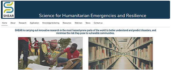
On 3rd December 2020, LANDSLIP consortium members presented at a session hosted by the wider SHEAR programme at Understanding Risk Forum 2020 on landslide early warning systems. The session presented an overview of landslide early warning systems from both a technical and operational perspective, drawing on experiences and knowledge across the globe and case studies of SHEAR’s LANDSLIP and Landslide EVO projects.
The keynote session was delivered by LANDSLIP’s Co-PI Emma Bee (British Geological Survey) and presented a high-level overview of landslide early warning systems and also highlighted the importance of the physical science, social science, and practitioner experience, knowledge and skills in building and developing these systems.
Presentations by LANDSLIP team members included:
- The components and functionality of regional landslide forecasting - Mauro Rossi, Consiglio Nazionale delle Ricerche
- The mapping of landslide susceptibility - Claire Dashwood, British Geological Survey
- Using weather patterns for landslide forecasting - Robert Neal, UK Met Office
- Data needs for landslide forecasting - Alessandro Mondini, Consiglio Nazionale delle Ricerche
- The role of social science in developing landslide early warning systems - Anshu Ogra, King’s College London
- Developing informational tools for decision makers, in the form of bulletins, early action protocols and standard operating procedures - Mirianna Budimir, Practical Action Consulting UK
- Reflections on the development of a prototype regional landslide early warning system in India through the SHEAR programme - Saibal Ghosh, Geological Survey of India
All of the recordings can be viewed here
October 2020: Mobile phone technologies for Disaster Risk Management workshop
 Program")
On 14th October 2020, the Science for Humanitarian Emergencies and Resilience (SHEAR) Programme hosted a virtual workshop that explored the use of mobile phone technologies, including applications and SMS messaging, to support Disaster Risk Management. The workshop was led by a group composed of LANDSLIP, SHEAR Knowledge Brokering, and Landslide EVO project team members.
The workshop brought together more than fifty members from across the SHEAR Programme and invited perspectives from the wider Disaster Risk Management community to share their experiences, identify what opportunities and lessons have been learned, and generate the most important challenges and opportunities of mobile phone technology use in Disaster Risk Management.
LANDSLIP-specific presentations included:
- Landslide documentation in India using “Landslide Tracker”- A crowd sourcing mobile application - Gokul Halan, Keystone Foundation
- Role of mobile phones in Disaster Risk Management research: Perspectives from SHEAR PhD students - Shreyasi Choudhury and Peter McGowran, King’s College London
- The experience of SaveTheHills in disaster information exchange and knowledge sharing using WhatsApp - Wg Cdr Praful Rao and Dr Nima Doma Lama, SaveTheHills
Reflections from the workshop are captured and summarised in this short video.
August and September 2020: Capacity building workshops for district level staff
")
Between August and September 2020 the Geological Survey of India coordinated a series of workshops with the Darjeeling and Nilgiris District Administration. The workshops were attended by more than 40 participants, representing the district, block, gram panchayats, line departments concerned, municipalities, and town panchayats, etc. These workshops aimed to improve knowledge of the experimental regional landslide early warning system within the government staff at the district and sub-district level, as well as build capacities of systematic landslide documentation, using both paper formats and mobile format.
The workshops helped the Geological Survey of India obtain a more nuanced understanding of the potential and limitations of district and sub-district officials to participate in the experimental regional landslide early warning system. This knowledge will help the district and sub-district officials to support the improved systematic documentation of both rainfall and landslide incident data in the districts concerned during the monsoon periods, especially during the time when the experimental early warning bulletins are issued.
All data gathered will contribute to supporting evaluation of the experimental landslide forecasts. The workshops also helped to strengthen the overall relationship of district and sub-district officials with the Geological Survey of India as well as with the partners of the LANDSLIP project.
June and July 2020: Pre-monsoon workshops with District Disaster Management Authority
")
")
Pre-monsoon workshops were held in June and July 2020 for the Darjeeling and the Nilgiris Districts, India. The Geological Survey of India led the workshops with State and District Disaster Management Authorities in attendance, along with other LANDSLIP team partners, to mark the launch of the experimental, prototype regional landslide forecasting in the districts. The virtual events were the culmination of several interactions (both formal and informal) held with the district officials in the run up to the launch.
In the workshops, the key elements of the experimental regional forecasting system were presented to the participants, together with the processes envisaged for testing and evaluation of the experimental regional early warning bulletins which are being issued for Darjeeling district from 2020 monsoon onwards, on every working day.
A landslide manual providing all relevant information prepared for the district level officials on the experimental landslide prototype early forecasting system was also presented and discussed at the meeting. The workshops outlined and discussed the requests by the LANDSLIP consortium for access to systematic data on rainfall and landslide incidents (through paper format or mobile application for landslide tracking), together with feedback on the various aspects of the early warning forecasts. The details of safety and security procedures, precautions to be observed in tracking of landslides, especially during the COVID-19 pandemic, was also discussed during the workshops.
May and June 2020: Pre-monsoon data collection workshops with field partners

LANDSLIP field partners SaveTheHills and Keystone Foundation organised capacity building workshops for data collectors (individuals, volunteers, students of geology and others) on rainfall and landslide tracking on a systematic basis, using both the paper format developed in the frame of the LANDSLIP project, as well as mobile application for landslide tracking (app concept and software developed by Amrita University and content contributed by LANDSLIP partners). The safety precautions to be adopted while tracking landslides, together with the local COVID-19 protocols to be strictly observed were also elaborated during the workshops, which took place between May and July of 2020.
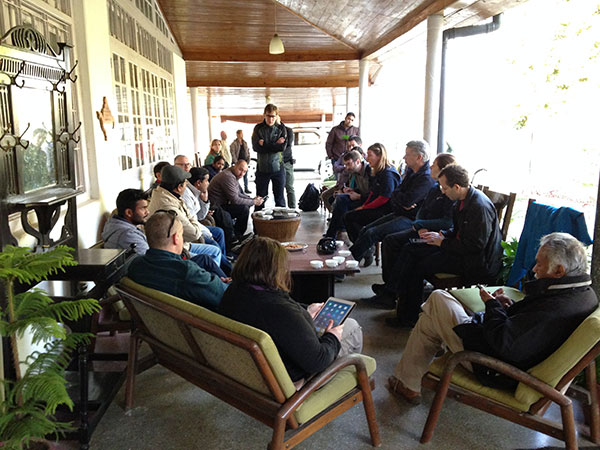
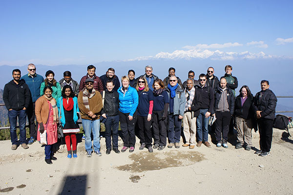
February 2020: LANDSLIP annual meeting

In February 2020, over thirty members of the consortium met at the TERI retreat near Delhi for our LANDSLIP annual meeting. Consortium members reflected on the progress and achievements since the beginning of the project and mapped out our remaining ambitions and outputs. Legacy beyond the end of the project was the main focus of the workshop.
2019
10 December 2019: LANDSLIP meeting with the District Collector, The Nilgiris

LANDSLIP consortium members from King’s College London, British Geological Survey, Geological Survey of India, Practical Action (India) along with their local partners the Keystone Foundation met with Ms. J. Innocent Divya, District Collector and Ms. Geetha Priya her Personal Assistant (General). Purpose of this meeting was to a) update the District Collector about LANDSLIP’s progress; b) share landslide data requirements for evaluation of the model and c) outline project’s planned interaction with her office in the coming year. This meeting lasted for approximately an hour. Ms. Divya promised her complete support in data collection process and in helping organise meetings with the district and sub-district disaster management officials in 2020.
December 2019: Other meetings and field visit in December 2019
LANDSLIP team separately met with Ms. Geetha Priya (Personal Assistant to the District Collector and contact person for LANDSLIP project in the Nilgiris). In this meeting LANDSLIP team once again updated her about the progress of the work and shared the specific data requirements to evaluate the model in the coming monsoon season. She ensured her complete support in the data collection process. A subset of LANDSLIP team also met with Mr. Ranjeet Singh, Sub-Collector Coonoor and Mr. Kupuraj, Tehsildar Coonoor on 10th December and Ms. Mohana, Tehsildar Kotagiri on 12th December. Mr. Ranjeet Singh emphasised on the need for community engagement to further strengthen the usability of the landslide forecast. Mr. Kuppraj and Ms Mohana promised their full support in the data collection process during the 2020 monsoon. On 10th December LANDSLIP team lead by the GSI partners visited some of the 2019 monsoon landslide sites.


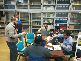
December 2019: LANDSLIP internal discussions about landside App at Keystone foundation on 11th December 2019
On 11th December 2019 LANDSLIP team members from Kings College London, Geological Survey of India and Amrita university held a day long discussion on the progress of landslide app being developed by Amrita university at Keystone foundation. The App is aimed to help GSI in the data collection process by crowd sourcing information from local community and government officials.


November 2019: LANDSLIP Working meeting at Geological Survey of India: 25th – 29th November 2019
LANDSLIP Consortium members from the British Geological Survey (BGS), Kings College London (KCL), Consiglio Nazionale delle Ricerche (CNR), Practical Action-UK (PAc-UK), Practical Action-India (PAc-I) and the UK Met Office (UKMO) received a very warm welcome by the Geological Survey of India (GSI) at the end of November as they met in Kolkata for a week of focussed discussions. The aim of the visit was to review aspects of the prototype landslide early warning system built to date so that information gaps were identified and an operating protocol established for future testing. The project and recent progress was presented to the Director General of GSI, Dr S. N Meshram and several senior GSI officials, including Dr R S Garkhal, Dr K. Jayabalan, Dr S. Raju, at the meeting’s inauguration ceremony. Significant progress was made during the week, with discussions and actions focussing around data collection, formulation and content of a prototype landslide bulletin and how LANDSLIP ensures a legacy.


November 2019: LANDSLIP meeting with District Magistrate Office, Darjeeling 29th November 2019
A sub-set of LANDSLIP Consortium members from the British Geological Survey (BGS), Kings College London (KCL), Geological Survey of India (GSI), Consiglio Nazionale delle Ricerche (CNR) and Practical Action-India (PAc-I) returned to Darjeeling on the 29th November to meet with the District Magistrate’s Office and Officials and Darjeeling’s District, Block and Taluk level disaster management officials. During the visit, LANDSLIP presented an overview of LANSLIP’s progress to date including interactions with the local officials and the prototype bulletin and its limitations. Future engagements with the district authorities and LANDSLIP were discussed, especially regarding how their relationship with GSI would develop as the prototype landslide early warning system moved into an experimental stage.


November 2019: LANDSLIP meeting with Save The Hills, Darjeeling 29th November 2019

A sub-set of LANDSLIP Consortium members from the British Geological Survey (BGS), Kings College London (KCL), Geological Survey of India (GSI), Consiglio Nazionale delle Ricerche (CNR) and Practical Action-India (PAc-I) met with Save The Hills, an NGO based in Darjeeling working with PAC India and provide local support to the LANDSLIP project. Discussions focussed around how they could help support LANDSLIP capture landslide information. Widespread information about all landslides, regardless of whether there has been an impact, captured with date/time and location of occurrence is fundamental to the development of robust scientific models and the team discussed how thus this data and information capture could be done in a safe and a systematic way and as part of LANDSLIP’s legacy. The meeting in Darjeeling provided a good foundation for continued discussions over the coming months.
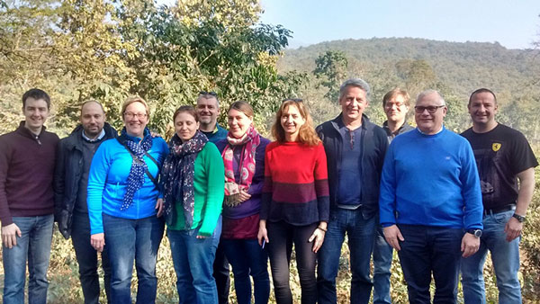
September 2019: SHEAR Annual meeting 10/11th September 2019 - Kings College London
 representing LANDSLIP at the SHEAR annual meeting in London 2019.")
On the 10th and 11th of September 2019 the different SHEAR projects came together and shared learning to support each other's work and the programme's goals. The conference focused on the theme of progress towards impact-based forecasting of hazards, and thinking about how to get the right information to the right people in the right ways. Over the course of two days, a variety of plenary sessions, panel discussions and breakout sessions, explored key topics relating to advances in forecasting, and applications for effective early action.
July 2019: Publication about weather pattern definitions for India

Colelagues from the MetOffice published a paper about "Deriving optimal weather pattern definitions for the representation of precipitation variability over India".
This study utilizes cluster analysis to produce sets of weather patterns for the Indian subcontinent. These patterns have been developed with future applications in mind; specifically relating to the occurrence of high‐impact weather and meteorologically induced hazards such as landslides. The weather patterns are also suited for use within probabilistic medium‐ to long‐range weather pattern forecasting tools driven by ensemble prediction systems.
This work was carried out as part of the LANDSLIP project. This work and some of its contributors (Robert Neal, Joanne Robbins and Rutger Dankers) were also supported by the Met Office Weather and Climate Science for Service Partnership (WCSSP) India Programme as part of the Newton‐Bhabha Fund.
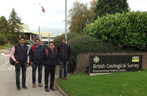
June 2019: 5th visit from GSI colleagues to Italy and the UK

In June 2019 the 5th workshop and training session took place again at the BGS headquarter in Keyworth and the CNR office in Italy. Colelagues from India joined this workshops and meetings. Main topics discussed:
- 3D visionary training
- Landslide bulletins and development of a guideline (SOP) for bulletin generation
- Weather regimes
- landslide modelling review, landslide susceptibility, landslide thresholds and forecasting
- short-term landslide forecasting
- GSI reflections on previous works
January – February 2019: 4th visit from GSI colleagues to Italy

Again four colelagues from the Indian geologcial Survey (GSI) joined meetings and trainings sessions at the CNR office in Italy. Colleagues from BGS and from MetOffice joined several discussions in Italy. This time the discussion focused on:
- Weather regimes, landslide susceptibility, landslide thresholds and forecasting, institutional mapping
- Weather regimes
- Updates on landslide modelling, landslide susceptibility, landslide thresholds and forecasting
- short-term landslide forecasting review
- GSI reflections on previous works
- Bulletin discussions
2018
June – July 2018: 3rd visit from GSI colleagues to the UK and Italy
From June to July 2018 several workshops and training sessions toke place in the Uk at the BGS Headquarter in Keyworth, the MetOffice in Exeter and at the CNR office in Perugia,Italy. 4 colleagues from the Geological Survey of India (GSI) joined these discussions. Main topics discussed during this vist were:
- 3D visionary training
- Basic R training
- Remote sensing training
- Fieldwork (usage of SIGMA in the field)
- Weather regimes and weather patterns
- Landslide susceptibility and statistical models
- Landslide forecasting and thresholds
April 2018: SHEAR EGU meeting
On the 11th of April a SHEAR meeting took place at the EGU conference in Vienna. The LANDSLIP project was introduced by partners from the MetOffice, BGS and Pratical Action UK.
Aim of this meeting was to identify areas of overlapping interest in the different projects. The meeting was organized from the SHEAR Knowledge Broker team.
March 2018: Workpackage 5 meeting in India
From the 08/03/2018 to the 09/03/2018 consortium partners from Amrita University, Newcastle University, KCL, BGS met in India to discuss LANDSLIP_NERC WP5B social media research, results, ontology and usability of social media for landslide early warning systems.
February 2018: Presentation of the LANDSLIP project at the
AOGS–EGU Joint conference in the Philippines
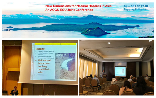
From the 04/02/2018 until the 08/02/2018 the international AOGS–EGU Joint conference took place in the Philippines with the aim to discuss current advances in knowledge and new perspectives relevant to natural hazards in the Asian region
Professor Bruce Malamud from KCL and Dr Alessandro Mondini from CNR talked about the LANDSLIP project in their presentations at this conference.
The titles of their presentations were:
- Multi–hazard interactions involving landslides in India
- Spatial Autocorrelation Changes in Multitemporal SAR Images for Automatic Event Landslides Detection, the LANDSLIP project
Prof. Bruce Malamud was also chairman of the session Natural hazard communications, warning systems and monitoring, while Dr Alessandro Mondini was one of the chairpersons in the session Transient and long–term effects of catastrophic perturbations.
January – February 2018: 2nd visit from colleagues the Geological Survey
of India to BGS Keyworth in the UK and CNR in Italy
From the 16th of January until the 21th of February, colleagues from the Indian Geological Survey came again to Europe. This time Meetings and discussion but also some training sessions were done in the UK at the BGS but also in Perugia in Italy at CNR. Main topics were the discussions about data and data quality, evaluation of landslide dynamics and threshold development for Nilgiris and Darjeeling, Multi-temp landslide database, optimising slope unit partition for landslide susceptibility, estimate of landslide hazard and EWS and discussions about landslide units and domains. Training session were done around landslide mapping, empirical rainfall threshold definitions for landslides, statistical data analysis and susceptibility model evaluation.
2017
December 2017: second annual partners project meeting for
LANDSLIP and stakeholder workshop
From 11–15 December 2017 the project partners met in Coimbatore (India) to discuss progress and further activities. A one–day field visit to some landslides in Nilgiris was done.
Furthermore, a stakeholder meeting was organised for the last part of the visit.
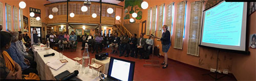
The Regional Stakeholder Workshop of LANDSLIP was organised at Keystone Foundation, Kotagiri on 14th December, 2017.
The objectives of this LANDSLIP regional workshop were:
- To apprise the regional/local stakeholders of the LANDSLIP project, its various elements and approaches, together with the progress achieved so far
- To obtain feedback, suggestions and perspectives of the regional/stakeholders on the strategies, approaches and activities of the project
- To enable articulation of the stakeholders of their needs, demands and expectations from LANDSLIP keeping in view the evolving context and the disaster situation in the Nilgiris
Participants of this workshop were from different Indian departments, agencies, Institutes and organisations. It was a very helpful and interesting discussion that with a lot of important insight and information about the Nilgiris region that will help to advance the research work of this project.
October 2017: visit from the Geological Survey of India to BGS Keyworth
From 02 October until 03 November 2017 four colleagues from the Geological Survey of India (GSI) visited the BGS dead office in Keyworth (UK). The main purpose was to enable a two-way flow of data, information and knowledge to enable collaborative research in the fields of earth sciences, mineral prospecting and disaster management.
During this visit the colleagues from GSI got an overview of the work and research of the BGS. This included also some training sessions and a one-week field trip to Scotland. During different presentations and discussions, the Indian representatives reported on their landslide work in Darjeeling and Nilgiris. Existing landslide susceptibility maps and procedures were presented and discussed.
October 2017: NERC SHEAR LANDSLIP WP3/4 meeting
From 19–20 October 2017 members from the work packages 3 and 4 met at the BGS in Keyworth and discussed the current state of work and research. Main focuses were existing data and GIS-files for the two study areas, forecasting methodologies, and weather regimes. Different methodologies about landslide susceptibility and early warning from GSI India, BGS and CNR were discussed.
Further steps and works were discussed and different activities were planned.
January 2017: kick-off meeting in India
From 09–25 January 2017, 31 LANDSLIP investigators from nine organisations in India, UK and Italy met in India to discuss the base elements for the project and other project planning activities, including presentations from all work packages.
In addition to the consortium meeting, stakeholder meetings and workshops were held Nilgiris, New Delhi and Darjeeling. Stakeholder and end-user relevant information and needs were discussed.
One field trip to the Darjeeling area and one to Nilgiris were undertaken, and helped the European project partners to gain insight into these two landslide areas.