WP4: landscape dynamics
Task leads: Geological Survey of India, British Geological Survey, Consiglio Nazionale delle Ricerche
Tasks
Task 4.1: preparation of landslide and other landscape dynamics thematic data
Task 4.2: use/development of semi-automatic image processing for landslide inventories
Task 4.3: hazard susceptibility modelling: landslide types and domains
Key deliverables
- enhanced landslide inventories, data and thematic maps in pilot areas
- procedure for landslide monitoring using remote-sensing techniques
- landslide hazard models for pilot areas delivered as web-mapping services
WP4 will work closely with WPs 2, 3 and 5 to:
- enhance current landslide event and process knowledge (e.g. conditioning and triggering factors) in pilot-study areas
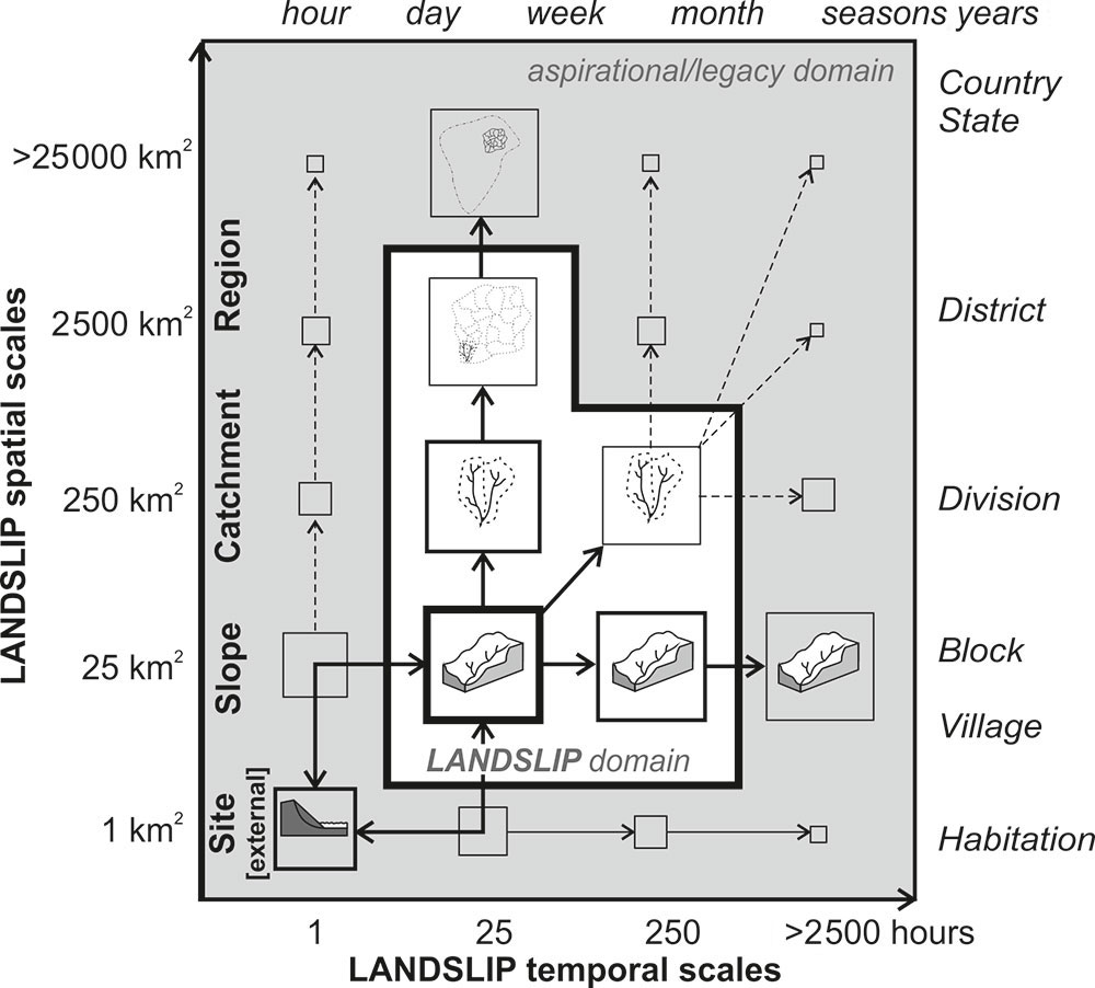
- deliver hazard models for pilot-study areas as web-mapping services on a slope to region scale
We recognise that India has significant expertise in landslide risk assessment and site-specific early-warning sensor networks. A number of these leading Indian experts are core members of our team.
Pre-conditioning factors
- geology
- topography
- Quaternary history
- vegetation change
- tectonic activity
- land use
- antecedent moisture
Triggering factors
- rainfall
- changes in water levels
- loading/unloading
- earthquakes