WP5: social dynamics and vulnerability
Tasks
Task leads: King's College London, Practical Action UK, Practical Action India, Geological Survey of India
Task 5.1: source and prepare data on vulnerability and impact
Task 5.2: map out institutional landscape
Task 5.3: compile and construct case histories of impact through human-built systems/policy
Task 5.4: compile participatory vulnerability capacity assessments (PVCAs) and assess gaps
Task leads: Amrita, Newcastle University
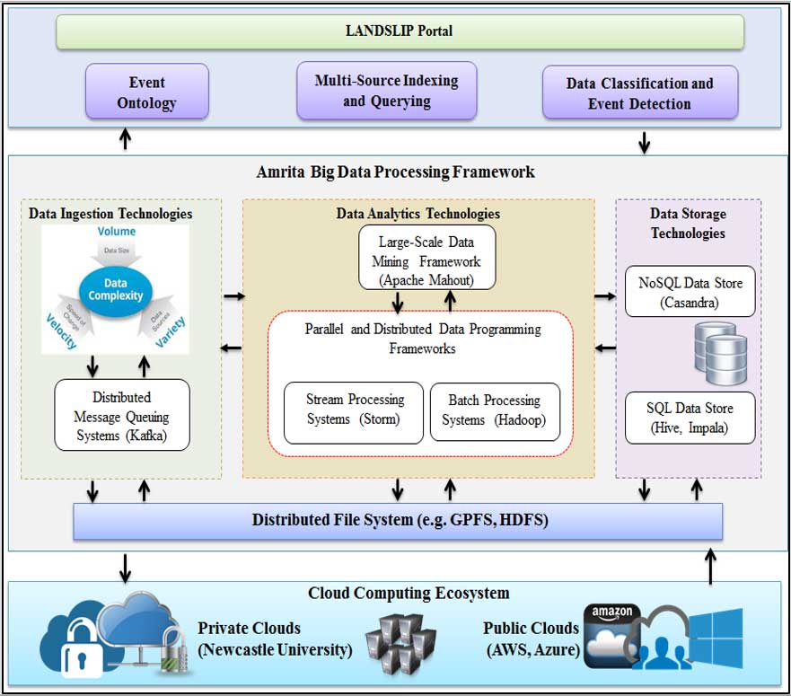
Task 5.5: develop ontology: social analytic terms related to landslide hazards
Task 5.6: develop multi-source social platform indexing and querying algorithms
Task 5.7: develop high performance data classification/event-detection algorithms
Task 5.8: develop mobile phone app
Key deliverables
In collaboration with the WP2 stakeholder user group:
- Spreadsheet: vulnerability and impact data summary and links
- Report: institutional landscape for landslide risk assessment and EWS
- Report: landslide-related case histories of impact
- Report: compiled PVCAs and gaps
- Report: social analytic terms and their development
- Index and report: social analytic platform index
- Algorithm and report: data-classification algorithm and event detection
- SMS protocol and mobile phone app
The first part of WP5 on social dynamics examines several key areas:
- sourcing and preparing data on vulnerability and impact, using recent landslide events, peer-reviewed literature, grey literature, images, interviews and oral histories
- institutional landscapes — who is responsible for what? Using documentary analyses, interviews
- participatory vulnerability capacity assessments, where we compile existing PVCAs. We have already documented a number and have links via our consortium members. We will then assess gaps with our own work, and work with stakeholders to enhance these PVCAs.
In the second part of WP5 we focus on social analytics and SMS protocol. These social analytics address landslide-related events, both historical and real-time that occur during the grant.
The two main types of harvested data are:
- publically available data
- mobile phone application data
We will also use these methods to communicate landslide risk assessments and early-warning information to stakeholders. These will enhance other communication methods (e.g., radio, newspaper) linked to WP7.
We estimate 10–15 per cent of the Indian population will be able to currently access internet-based information, with numbers rapidly growing, and that any social analytics we do are in conjunction with the other meteorological, landscape and multi-hazard dynamics.
Task 5.1: data on vulnerability and impact
- infrastructure, vulnerability, exposure data
- socio-economic impacts
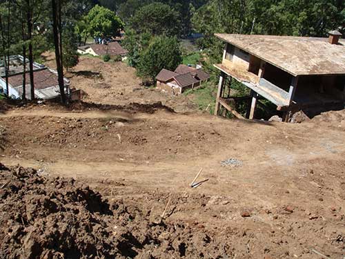
Recent-past landslide-related events, media, peer-review, grey literature, images, interviews and oral histories.
Task 5.2: institutional landscapes
- who is responsible for what?
Documentary analysis and interviews.
Task 5.4 PVCAs:
- compile existing PVCAs at local/district levels
- work with local stakeholders to enhance PVCAs
Surveys, community participatory workshops and stakeholder spatial vulnerability mapping.
| Year | Indian internet users (via any device) (millions) |
Penetration (% of population) |
|---|---|---|
| 2016* | 462 | 34.8 |
| 2015 | 354 | 27.0 |
| 2014 | 233 | 18.0 |
| 2013 | 193 | 15.1 |
| 2012 | 159 | 12.6 |
| 2011 | 126 | 10.1 |
* = estimate